Is there anything you would like to know about the Borough of Stockton, its history, its industries, its buildings or its people? Just add a comment with your query to this page and we will endeavour to answer it. If we don’t know the answer it may well be that some of our site visitors do…
NOTE – Please use the ‘Reply‘ option when answering a query.
Hi where did Head Wrightson FC play? Was it where Northern League club Thornaby play now?
Do you know a Margaret or Mary Mcvay?
Does anyone remember the Price family who had a shop in Ware Street in Tilery in the 1950’s?
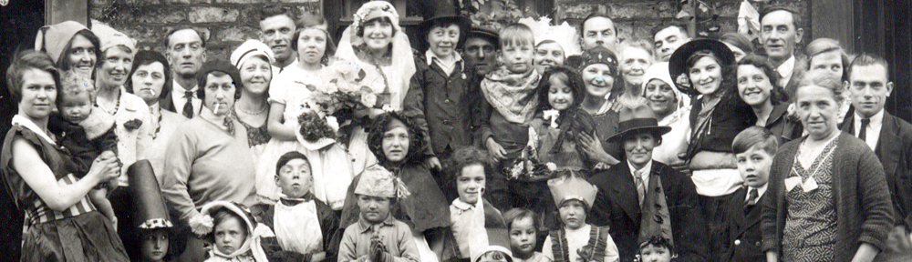
Does anyone have any old photos of Ragworth late 60s early 70s?
Hi Ann, my lovely wonderful aunt lived at 56 Doncaster Cresent from it being built, she had perhaps the only tv on the estate, no kids were turned away at childrens hour, she was Lizzy Evens do you remember her and family?
Derek.
I was only 2, it’s my brother who might remember, his name is Kenneth Mockler. We lived at 55 Dumbarton Avenue, he was 14 in 1972.
Hi Ann, yes I’m talking about Ragworth when it was first built, aunty Lizzie lived there until she passed away, she was well known on the estate.
All the best.
Derek.
I’m hoping someone will be able to help me, as my memory has let me down.
I cannot for the love of me remember which buildings , in the 60s, were on the site where the ” replacement ” Station pub is situated on Bishopton Lane,
I remember Arrowsmiths, then Guthries Taxis and Fairless engineering then The Board inn. There was a decorators shop where my mate Phil Ramberts mam (Mollie I think) worked then a doctors. Its the little bit between Inkerman St and Alma St that I’m stuck on.
Hello , my great aunt sadly died when she was 7 in 1922. We believe she was buried in Thornaby cemetery. There is no headstone for her but I do have a plot number. Unfortunately I cannot find a plot map of thornaby cemetery anywhere. Please could someone assist in where I could find the plot map of Thornaby cemetery so we can find her resting place please?
You could try asking the people at Find a Grave to track down the grave. Give them all the info you have. https://www.findagrave.com/
I got a plan of a Stockton cemetery when I emailed the register office to search for an ancestor’s burial plot.
Hello, I emailed Stockton central library but they only had a copy of a plot map with the letter sections on rather than individual plot sections. So I can see the area she would be buried but not the exact location.
Hi. I would try the Council. I know that workmen have to liaise with Stockton Council re. Durham Road cemetery, and get their permission to do work there, eg. cleaning headstones, tidy graves. Plot no’s are used.
Dave.
Thank you, brilliant I will try that.
Thank you for your reply. I hope you are successful. Let me know how you get on, please. Then if another query is posed, I will be able to give up to date info. Best wishes.
Hello Lottie. I was wondering if you live in the Stockton area as i had a plot no. relating to a burial in the 1920’s. On a visit to Thornaby cemetery to place some flowers i noticed some workmen in a portacabin in the older part of the cemetery and i asked if they could show me where this plot was. They were extremely helpful and on finding the correct row they paced out where the plot would be. If you dont live in the local area you could try contacting the bereavement dept. of Stockton’s Care for your Area to see if they could assist you.
Regards
Christine Mothersdale
Hi, thank you. I live close to the area to be able to visit. I tried to email the library but they only sent me a plot map of the letter sections. I have a full plot number but as it’s from 1922 there are wide open spaces with missing headstones. The headstones that are there don’t have any plot numbers on so I have an area she is in but not the actual location.
Next time I’m there I’ll hopefully see someone working nearby. Thank you
Do you know which section ?
I have sections B & C.
It’s plot KG, I went to the area and they headstones that are there are from the same month and year.
My grandmother burial. GM33
G : Section
M33 : Location in Section.
The cemetery has workmen who look after it, cutting grass etc. I myself have approached them and asked for help when looking for a grave location, they are very helpful, if you can’t find them they have a compound in one corner where they store tools and have a cabin. You will also find posts within the cemetery which have letters on them, generally on the corners of each section, these have letters on them (sometimes 4,) which help locate specific sections. Then depending on age gravestones have letters and numbers marked on them denoting specific plot section, and number, these are normally on the side or back of the gravestones near its base. If you look at a selection of these you should be able to work out that the lines of graves will be labelled numerically one way and alphabetically the other way. By figuring this out you will be able to find you unmarked grave. Note though that some cemetery’s as they have expanded have had to add further sections which have duplicate section letters as I found in Oxbridge cemetery, two sections same letters different locations. Some cemetery’s also have notice boards within them with a location map to help you, try all entrances as if one exists it may not be where you normally enter, good luck young lady.
John l
Here is a link to the plan of the cemetery. https://images.findagrave.com/photos/2022/46/CEM2196316_9fd6026f-351c-485b-ac83-9d4bace16aaf.jpeg
My father was born in Langley Street, does anyone know which direction, and which side of the street, the odd and even numbers ran please?
Hi Peter, the house numbers started at the southern end (nearest Bishopton Lane). The odd numbers were on the west side of the street (nearest to Alma St.), with #1 being on the corner with Parkin St.
Can anyone describe what the interior of the houses in Mary St, Alexandra St and Light Pipe Hall were like e.g. how many rooms upstairs and down, was there a bathroom, was the toilet indoors or down the yard? My great-grandparents lived in houses in these streets from the 1880s to at least 1911.
Where the bathstore was in Wellington Square, opposite the KFC, there used to be a DVD/Games rental store. Can anybody remember what it was called? I think it was early 00s. I’m sure it wasn’t Blockbuster, Global or Ritz, I’m sure it was its own thing….but I could be wrong
I am looking for a picture of the Stockton Ancients 1933 amateur cup final team.
My Great Grandfather was Lloyd Clarance Lessee & Manager at the
Theatre Royal , Stockton 1889. I enclose a photo of some of the memorabilia
I Have. I wonder if there is an interest in these pieces from The Manager now?
I could arrange to bring them to show The Manager if there is an interest. Thank you
Does anyone know what happened to Peter Burns born in Stanhope Road in Stockton on Tees early 80s?
What were the house types in Roseworth?
They are 2, 3 and 4 bed houses.
I was wondering if you could shed some light on the origins of the “Teesside Smell”. It would appear when the wind was in the right direction and the weather was sunny, and smelled of tomcat urine. It was rumoured that it came from I.C.I. Amines plant but I don’t believe that was proven. As an expat for the last 50 + years now living in Nottingham, the question has plagued me a lot and I’m sure one of Picture Stockton’s informed readers/members can put this one to rest for me. My memory of this is still very strong. Sunny day, deckchair out in garden when this white evil smelling mist would roll in ending sunbathing for the day. Over to you, please!
There was no single smell characteristic of ICI Billingham, since it would depend not only on wind direction but also on which plants had developed small leaks, pressure relief discharges etc.
Fishy smells would certainly come from the amines plants. However, one frequent smell was called “Iglodine” by my parents, being a heavy smell with a slight resemblance to iodine. I think this would have come mainly from the phenolics plants in Oil Works, possibly with addition of aldehydes and oxo-process alcohols from same general area.
The cat smell was notorious along with all the other obnoxious smells and discharges from the ICI.
On a perfectly sunny day, nice and warm, occasionally you would see a mist approach as the wind changed, along with it a foul Tomcat smell, the thing is we used to cycle to Seaton Snooks from Tilery via Haverton Hill and Port Clarence and once you got passed ICI there was the clear weather again.
At one stage cars driving near ICI the cars screen started to get wet, but on using the wipers the wet turned to a white’ish colour and warranted having to manually clean the screens.
Goodness knows what manner of discharges emanated from the vast ICI
plant, but it was a huge employer and provided an equally vast, very varied recreational opportunities, a good employer with a generous share scheme.
Hi John, I was brought up in Tilery & experienced the noxious pong emanating from ICI. You would have thought breathing in that stuff would have damaged your lungs but here I am at 85 still going strong! By the way my maiden name is Laing but I don’t think we’re related!
I posted a reply to this but am wondering if it was lost!
Sorry Bill, I was relying to a response you got from Josie Wales! Sorry for the confusion.
Hello Bill.
I can echo you problem reference replies not getting onto the site, to be fair to the good people involved I eventually noticed a change in ‘Logging In’ in so much that originally I would log into My WordPress site which then gave me access to the Stockton Live Site – Whereas now you can reply directly by providing your Email address which is not displayed and your name but if you would rather your name is not displayed then provide an alias.
Regards J.
Yes
Yes…. We had an exchange some years ago broaching the similarity in the surname and its spelling.
Dads Brother Bob & Tilly lived in number 28 and his other Brother Ernie & Dora lived in Kingston Street.
Does anyone remember the Wilson family from Lucy Street?
My father’s ancestors were Wilson’s coming from Billingham and Norton. Not sure where Lucy St is.
Regards
Lucy St was in the Tilery area of Stockton
Do you think that they were related to the Mr Wilson who managed the Co-op on Bishopton Lane and were stalwarts of the Newtown Methodist Church?
Bit of an odd one I know but does anyone remember where the public toilets were on Stockton high street mid to late 90’s?I have this vague recollection of having to use some grotty subterranean public convenience with steelpan toilets on the Highstreet as a child, possibly near the shambles but I am not sure if my memory is correct.
Were there underground toilets on the high street?Where were they and when were they removed?Do/did any subterranean spaces exist under the high street?
They were on the High Street opposite the Cinema
They were between the Town Hall and the Shambles, partially below ground.
Yes they were between the Shambles and the Town Hall
Your memory is correct. They were there since my childhood in the 1970s.
Despite rumours of tunnels under there, the toilets you mention were between the Town Hall and The Shambles, but were apparently flattened and filled in with concrete when pedestrianisation (is that a word?) was established in the High Street.
Does anyone have any information about a water mill at Wynyard?
I believe it was called Bluestone Mill and was located on the land outside of the main park, opposite the Golden Gates.
Thanks
Here is a quote from another poster (Bob Harbron) about the Mills in our area.
‘Wolviston mill before the coming of a good road sytem in the early 1800s, rivers streams and “Becks were the transport links, now known as “Billingham Beck”, it was tidal enough to support barges of both grain and animals as late as the 1880s. As late as 1900 it was possible to row or sail into the Tees. This “Beck” supported 7 watermills, some dating back almost a thousand years. In 1982 , Norton Heritage, “walked” the mills. “BISHOPTON”, near Redmarshall was fed by water diverted to the moat of the 1100 Bishopton Castle, (The 60ft earth Motte and defensive water ditches are still visible. THORPE. The 1700 mill house and pond are to the west of the village. A legend tells o “Megs Maddison Pool” a witch who waits for those who foolishly venture into her deep pool. BLAKISTON. The manorial mill again of the Georgian era was to the north east of the present bridge in Blakiston Lane a flat with stray brick and tile “finds” WYNYARD (Bluestone-Mill) the remains are on private-land and once had both a mill and bridge from Blakiston Lane, through Bottle-Hill farm land to the Wynyard Estate. Sandstone block of the bridge are visible as well as brick, tiles and metal wheel securing bolts. As late as 1910 this bridge was in use for both horses and servants of the Hall (Bluestone (French), the type of fine grinding wheel of the mill) WOLVISTON As the population of Teesside grew the need for both corn and milling expanded and the small cottage-mill of the village extended with another “Penthouse Wheel”. During the 1960s the owner attempted to restore this mill but fire thwarted his effort BISHOPSMILL. The oldest mill dating to Saxon times, it’s importance was such that after the Norman Conquest the Bishop of Durham ordered all similar mills to be destroyed fining and imprisoning those who did’nt use his Mill. The 1977 “Dig”, due to its destruction to make way for the A19 traced brick-work and artifacts back almost 400 years. BILLINGHAM A large Georgian brick building it was purchased in a derelict state by I.C.I and became part of the New Road Tank-Farm site. All these Mills still have traces of the original water supply ditches and ponds. Most of the millers of the last 300 years were and their decendents are, of The Society of Friends (Quakers), with their Churchyard and memorial stones are in “Ralphs-Field” rear of the Friends Meeting House The Green Norton-on-Tees.’
Yes, Bluestone Mill was just south of Bottle Hill Farm. All I can add that it was a corn mill.
I also found Bob Habron’s comment on a previous PS post (“Recollections of a River”):
“WYNYARD (Bluestone-Mill) the remains are on private-land and once had both a mill and bridge from Blakeston Lane, through Bottle-Hill farm land to the Wynyard Estate Sandstone block of the bridge are visible as well as brick, tiles and metal wheel securing bolts. As late as 1910 this bridge was in use for both horses and servants of the Hall (Bluestone (French), the type of fine grinding wheel of the mill) “
Hello all,
The Reference Library has received an enquiry from someone who is looking for photos of staff who worked at Norton Hardwick from around 1925 – 1942. Does anyone have or know of any such photos?
Any help would be very much appreciated.
Thanks,
Hannah
Stockton Reference Library
Quite possibly it would be The Village school. The school is still there and its only a couple of hundred yards as you turn from Laburnum Avenue onto Thornaby Road. There is also the Robert Atkinson building which was a school but is no longer used as such but this is on Thorntree Road and a bit further from Laburnum Ave.
Do you have a picture of the old police box that used to be on the corner of the High street and Bishop street in the 1950s?
thanks x
Hi does anyone have any photos of Laburnum AVE, Thornaby Stockton-on-Tees. My mum grew up there. Does anyone remember the fish and chip shop and a sweet shop? My nana worked in the chip shop, not sure what year maybe 40’s. Looking for photos from 1930-1970. My grandparents were Thomas Gibson and Nancy does anyone remember them. The Walker family lived next door. Thank you
Mrs Campbell .
Does anybody know what the school was called near Laburnum AVE, Thornaby in the 1930’s. My mum was born in 1931 and grew up in Laburnum AVE. Mum always said nana walked her to school so guessing it was close.
thank you
mrs Campbell
Does anyone have any images of Inkerman Street Stockton. This is where my dear Nan lived before compulsory purchase and moving to Hardwick Estate. I lost dad a few years ago and this was his childhood home. I only visited as a baby and can barely remember I know it was near the railway station. Thank you Julia
There is an office block opposite the top of the steps leading to Phoenix Sidings from Bishopton Road. When i was young, living at Browns Bridge, it , and the yard behind it were home to A Williamsons and F.V.S. I remember the trailers loaded with Heinz products, from the nearby warehouses, roped and sheeted ( How many HGV drivers could do that today? ) on a Sunday, ready for an early start on Monday. I have convinced myself, although I could be mistaken, that there was a third company in that building, but I can’t for the love of me think what its name was. Can someone please put me out of my misery either way
This is very good. And much appreciated, but, it doesn’t answer the original post which was that Kiora Hall/Nordby was on Blakeston Lane and it’s quite obvious by all of our searches that it is on Ragpath Lane. But the gentleman (91 years old) who knew it as a boy said it was on Blakeston Lane? So my question is, was it ever on Blakeston Lane and if so when did it change to Ragpath Lane.
I shall try & find out for you Brian as my husband is adamant that it was on Blakeston Lane!
I looked at an old map of the area & Ragpath Lane which was named by the builder of Ragworth Estate, Harry Wragg, I believe, ended at Junction Rd. This was originally Blakeston Lane which then continued to Thorpe Thewles.
I was at Grangefield at that time, in fact that was my last year so perhaps your mum was younger than me. Unfortunately the school was demolished a couple of years ago. I no longer live in the area so am not sure what replaced it!
They have built a new Grangefield School on the site, it can be seen on the Street view option of Google maps.
Hello, I am researching my mother’s time at Grangefield Grammar School for girls. She attended from 1956, I think, until she completed her A Levels which I guess must have been around 1960. She was known then as Patricia (Pat) Drake. I don’t have any school photos (her family couldn’t afford to buy any) so I’d really love to locate a photograph with her in it. There is only one photo that exists of her as a child so this would be very precious. Thank you for any help you may be able to provide. The school seems to have changed so many times I wasn’t sure if there might be a physical archive I could search through?
Hello. I have an ancestor whose place of birth and residence in 1858 is documented as “Ferry Boat Thornaby” on the birth certificate. In the census of 1861 they are at 116 Trafalgar Street, Thornaby. They lived at different numbers of Trafalgar Street on 1851,1861& 1871 census. Would Ferry Boat Thornaby just have been used, as the birth informant (mother) was illiterate, or would the birth have been on the Ferry boat?
Perhaps the most well known of the ferry operators in the 1800s were the ‘Kelley/Kelly’ family, who lived on Trafalgar St. The ferry crossed from the end of Trafalgar St to where the car park is on the Stockton side next to the Princess Diana Bridge. Perhaps the address was the name of their ‘business base’.
Perhaps the name changed when Ragwoth was built, it was Blakeston Lane when my husband was a lad!
According to a 1900s map, before Roseworth and Ragworth Estates were built, Blakeston Lane looks as though it crosses Junction Road and carries on down to Ragworth. There’s no mention of Kiora Hall on the map, although there is a ‘ Norton Grange’ at around where Kiora Hall is. My guess would be that Blakeston Lane (at that time) carried on all the way through to Ragworth.
Kiora was built on the site of ‘Nordby’ which burned to the ground in 1899. Nordby and Nordby Cottage on Junction Rd. were renamed as Kiora. Albert Frederick Trechmann built (or possibly rented) a new house called Kiora on the site of Nordby by 1902. The source of the name remains unknown, but Alfred’s older brother Charles Otto, a marine biologist by trade and a keen and nationally recognised amateur geologist and mineralogist, had spent time in New Zealand, and it may be that this Maori greeting kia ora, (literally meaning ‘be well’) caught Albert’s imagination. Ragpath Lane replaced the lane (used the same route) which ran from Junction Road to Ragworth Farm (Mile House area)
l looked up the history of Kiora Hall as l expect you have & was surprised to find it was originally built for a Danish man called Nielsen. He had the property built on Gothenburg & then transported to the site. He named it Nordby after the area where he was born!
Yes Maureen I foiund the same info. It would seem that lots of Europen businessmen/women came across to live in Teesside in the 19c. I also found that their home was not called Kiora Hall at the outset…..I’m looking further.
Roseworth was built in the 1960’s. A search on Pc ” when was — built is worthwhile”
Roseworth was built in the 1950s. It was fully built when the OS surveyed it in 1958. (1″ map published 1961).
A little off topic here, Bob Easby, did you have Family in Craister Street Tilery ?.
JWL.
I am not aware of them, but it’s not a very common name, so possibly.
Just shows that one should not take the web at a glance. I looked again and found under “Discover Stockton” that Roseworth was build between 1949 and 1952.
Thanks for correcting me Bob.
Coincidentally, my dad lived on Roseworth Farm in the 30s. The family lived in a hut on the farm on Durham Road directly opposite the still standing spinney of pines. Later they moved to Myrtle Road where during the war, he spent many nights in an Anderson shelter in the garden, and when the Kiora guns went off he said the noise was absolutely tremendous!
I’ve seen Ragpath Lane marked as such on an OS map published 1859 (15+ years before even Nordby was built). It takes practically the same route as it does today, from its junction with Junction Road/Blakeston Lane to Darlington Lane, close to where Ragworth Farm was. So its name predates Nordby/Kiora Hall, and the Ragworth Estate. This means that, at least by the maps I’ve seen, Nordby/Kiora Hall could only ever have been on Ragpath Lane. It’s not difficult to imagine it was the route of a path to Ragworth Farm, later to become a lane.
I am willing to believe that the name Ragpath Lane evolved from Ragworth Lane by ‘word of mouth’, in a similar way that Lustrum Beck was previously Lustring Beck.