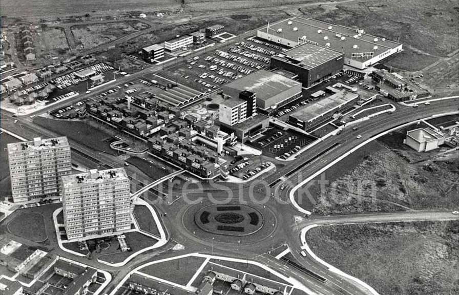
I remember it being like this in the mid 1970s when I played squash at the Pavilion and I remember the Mitchell Avenue shops coming down, but don’t have a date. Anyone want to make a guess?
Woolco, The Pavilion and the Golden Eagle can be seen as well as the soon to be demolished flats, the overhead walkway also appears as does the parade of shops and maisonettes fronting onto Mitchell Avenue, since demolished.
Photograph and details courtesy of Bruce Coleman.


This photo just catches the end of the old airfield runway, on the right, next to Woolco. The 1960’s town centre was a very bold & modern design. Love the paving circular patterns in St. Peter’s square, very much of it’s day. Looks like this was all demolished in 2007/8.
What was the 1st floor of Meynell House used for? it had a wavy roof and the 1st floor was mostly glazed? (https://picturestocktonarchive.files.wordpress.com/2017/09/t15671.jpg)
What an amazing place Woolco must have seemed when it opened. I barely remember going once or twice, but remember it being mentioned as a place people would go to, probably because of the late night opening? ( http://www.woolworthsmuseum.co.uk/woolco/woolcogallery.html )
LikeLike
Hi
remember this very well…I was a Woolco Trolley collector from 1971 to 73…hard work
LikeLike
Woolco… Loved that shop… Underground parking… As a kid it was awesome…
Didn’t like the dentists tho upstairs near the Yamaha organ shop.. 😬
LikeLike