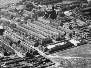
Kinnoull, Mill Lane / Dovecot Street

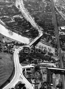
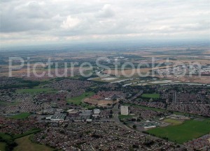
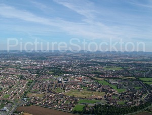
In the centre of this image is an interesting building on Dovecot St. that was mentioned in a Facebook group (Stockton Memories). The building stands out on maps & images as it was rather grand with a large formal walled garden. Built at the western edge of the town, on Mill Lane it would have had a pleasant position before being surrounded as the town expanded westwards.
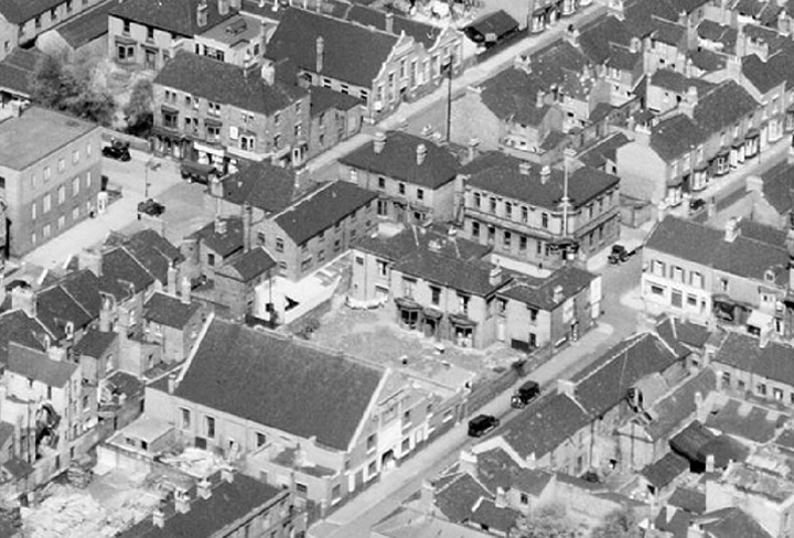
In the Facebook post Ann Davinson says:
“This was Kinnoull, the house stood at the top of Dovecot Street just beyond Skinner Street and was demolished in the sixties. My family lived there for many years.”
“[the date of the picture is] about 1925. They [Kennedy family] moved away in 1930.”
“It even had a ballroom!”

Another commenter mentions living in a single room there, as a baby, so must have later become a HMO before falling into disrepair as seen in this image.

Kelly’s Directory (1914) lists “Kinnoull” as occupied by Robert Frank Brittain (Chairman of Stockton-on-Tees Local Pensions Committee).
So I wonder if that is one of Ann’s relatives? or was it already called Kinnoull?

Looking at some maps:
• 1855: there is a smaller building on the same site, with a formal garden.
• 1891: shows a larger building. It is labelled as “Trevelyan Temperance Hotel” and still has a formal garden.
• 1939: the same building is shown but the southern end of the garden has been sold and built on.
The building was the “Palais De Dance” dance hall.
• Later maps show this, and neighbouring buildings were demolished and replaced with the large office block that still stands.
The offices are shown as “Government Offices” and I think it says “Inland Revenue & Ministry of Pensions & National Insurance”

You can also see Kinnoull in these 1924 images:
   EPW010138 ENGLAND (1924) | Britain From Above
   EPW010139 ENGLAND (1924) | Britain From Above
   EPW010140 ENGLAND (1924) | Britain From Above

… and after the Palais De Dance was built:
EAW013852 ENGLAND (1948). The town centre, Stockton-on-Tees, 1948

(If Ann Davison is reading this, perhaps you could give permission for the photo from Stockton Memories to be added to this Picture Stockton post?)

Details courtesy of Jonathan May.

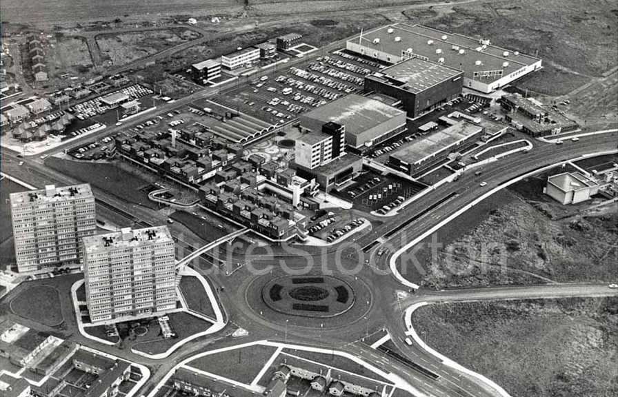
Aerial View over Thornaby Town Centre

I remember it being like this in the mid 1970s when I played squash at the Pavilion and I remember the Mitchell Avenue shops coming down, but don’t have a date. Anyone want to make a guess?

Woolco, The Pavilion and the Golden Eagle can be seen as well as the soon to be demolished flats, the overhead walkway also appears as does the parade of shops and maisonettes fronting onto Mitchell Avenue, since demolished.

Photograph and details courtesy of Bruce Coleman.

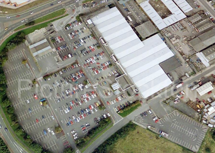
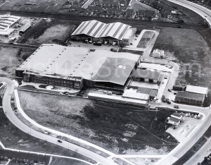
ASDA / Portrack Lane

Does anyone have pictures of the front of the building facing Portrack Lane circa and the rear warehouse truck entrance circa 1975/77?

I worked there until late 1977. Just trying to jog my memory as to were I would have parked my moped / motorcycles before leaving for pastures new.

Black was the shop. Red the warehouse. Orange the Petrol Station. Blue the public entrance. Green would be the staff entrance to ‘clock’ on. I either parked at the front staff entrance or around the back in the warehouse delivery area.

The first picture is from 2000 before the rebuild and the second is how it looks today.

Photograph and details courtesy of Glenn Atterton.

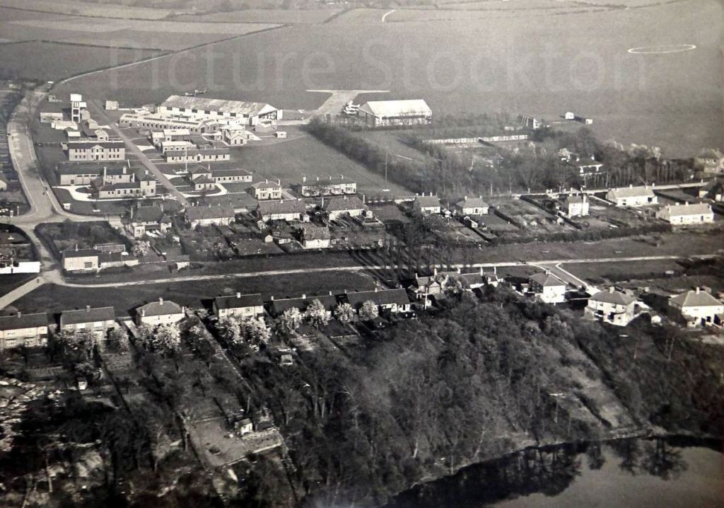
Thornaby Aerodrome

The shot is dated 1934 and shows the layout of what was to become RAF Thornaby.

The information I received with this picture says that the cluster of buildings disappearing off the top of the picture belonged to Stainsby Grange Farm, I think this places it at the top of the Acklam Road area of Middlesbrough.

The area at the bottom shows the river and Thornaby Village, complete with The Green and The Church, it is still a very pleasant enclave to this day.

Also in the picture is Millbank Lane which runs along the left hand side of the aerodrome, backing on to this road are a series of buildings that as far as I am aware are still there.

One of the buildings became the Thornaby Conservative Club (Non-Political), that sign always amused me, I had a number of pleasant evenings there on concert nights, another building is the Green Baize snooker hall, I have had many equally pleasant afternoons in there, it may even be the same building, does anybody know?.

The aerodrome its self had a very short concrete area, I presume it was for taxiing before take off and the grassed area was the runway, there are a few aircraft dotted about the area, all relatively small as was the case in the 1930s so grass runways were not unusual.

My Grandfather was stationed at RAF Thornaby during the Second World War, he had been in the RAF in the 1920s and was a reservist, even though he was over 40 at the time, he was a non combatant and my Aunt tells me he was involved in making dummy aircraft for standing around the airfield to give an impression of strength, I know this did happen but don’t know for sure it happened at Thornaby, he also served in Italy very late in the war after the Italian surrender.

Photo and details courtesy of Bruce Coleman

Aerial view over Billingham

t13668An aerial view of Billingham and the surrounding area. What can you see? Date unknown.


Image and information courtesy of Bruce Coleman…

The nearest I can get to dating this image is after 2006 because the La Ronde nightclub is missing, if the small section of white building to the very right centre of the image is part of the old ICI office block then it is before 2012, if it is not the ICI office then it is after 2012.

1: St. Cuthberts Church

2: The Smiths Arms

3: Wolviston Village

4: Dawson House

5: The Green

6: Town Centre

7: North School (Pentland Primary)

8: John Whitehead Park

9: The Picture House

10: Forum

11: “Billingham Stores” (Stockton Co-op)

12: Kennedy Gardens

13: Billingham Town Football Ground

14: Old Police Station ( Now a residential home)

15: South Modern School

16: “Tin Lizzie” footbridge

17: St. Johns School and Church

18: Billingham Baths

19: Synthonia Cricket Ground

20: Roseberry bridge

21: Synthonia Sports Stadium


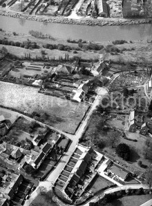
Portrack and Portrack/Tilery Primary School c1949

Two views of “Old Portrack” taken from the NCAP Scottish Library collection. They date from May 1949. Portrack stayed much the same until the mid-fifties when demolition began.
All that remains is part of St Annes Terrace and the more modern buildings of what, in my time, was called Portrack Primary. They run at about 30 degrees from the left hand corner of the lower picture. The taller buildings, which are at right angles to these, were demolished in the eighties, but there is a colour picture on Picture Stockton. These housed the infants, aged 5 to 7. The modern buildings covered the ages 8 to 11, when we would do our 11 plus.
The buildings surrounding the smaller playground belonged to the nursery classes and the school dinner canteen. They were temporary wartime structures, I believe and have now gone. The school dinners were appalling, but we nursery children were forced to eat it.

Details courtesy of Fred Starr.

An Aerial View of Haverton Hill

This aerial shot of Haverton Hill shows the Furness Estate quite clearly, particularly interesting is the view of ‘The Hostel’ near to the Circle on Belasis Avenue, I believe this was built to house shipyard workers just after the First World War, I remember it being used to house Hungarian refugees after the uprising in the 1950s and it later housed light industrial units including a soft drinks company called ‘Jonco’.

It is difficult to date the photograph but there are very few cars on the roads, the bus is probably one of Stockton Corporations Leyland PD2 models which were in production from the 1930s, I used to travel by bus fairly frequently through Haverton Hill in the 1950s and I don’t ever remember the route going down Marlborough Road, I do have a photo of a bus shelter on Marlborough Road in the 1950s so maybe my memory is not up to scratch.

Marlborough Road continues away to the left towards the Furness Sports Field, at the bottom right of the photo where Marlborough Road and Collingwood Road meet you can see the roof of the Methodist Chapel, next door to the left is a flat roofed building, this was always known as ‘The Welfare’, it was where we collected our concentrated orange juice, malt, National Dried Milk and the dreaded Cod Liver Oil.

Belasis Avenue continues off to the bottom right of the photo and passes the old fire station on its left then Charltons Pond on its right then Billingham South Modern School on its right and Billingham Stores (Co-op) and the Picture House at Mill Lane end, the bus actually travelled along Greenwood Road and met Belasis Avenue at the bottom of the bridge.

At the top right of the photograph the curve of the railway line heading towards Port Clarence and the Transporter area can be seen, just before the curve a single track line branches off to the left and crosses Hope Street and continues along to the clay pit and Saltholme Farm, as children we spent many happy hours playing around this area.

I remember my father mentioning a Cinema somewhere in the area of Tees Street and The Hostel, if anybody can pinpoint it for me I shall be most grateful.

Photograph and details courtesy of Bruce Coleman.